
Within the analysed area, about 2,5 km2 of landslides scars are observed. Some of past landslides seem to have been reactivated during these flooding/landslides event.
This is a preliminary analysis and has not yet been validated in the field. Please send ground feedback to United Nations Satellite Centre (UNOSAT).
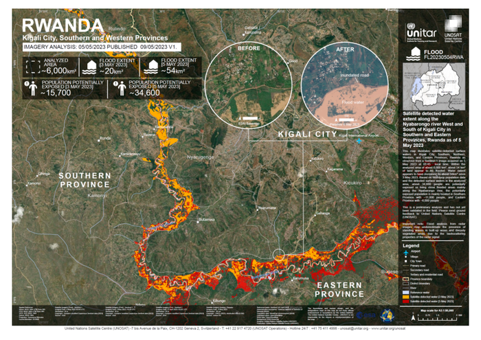
Satellite Imagery (Post) : Sentinel-2
Imagery Date: 7 May 2023 /08:30: UTC
Resolution: 10 m
Copyright : Contains modified Copernicus Sentinel data [2023]
Source : ESA
Satellite Imagery (Pre) : Sentinel-2
Imagery Date: 7 April 2023 / 08:30: UTC
Resolution: 10 m
Copyright : Contains modified Copernicus Sentinel data [2023]
Source : ESA
Reference water: Sentinel-1/21 April 2023
Administrative boundaries: National Institute of Statistics of Rwanda (NISR)
Population data: WorldPop Unconstrained [2020]

Subscribe to view notification of our daily news
RwandaPodium © All Rights Reserved. Powered by thesublime.rw